Place
Mamer Dam
Earthen dam · RA67MH0261
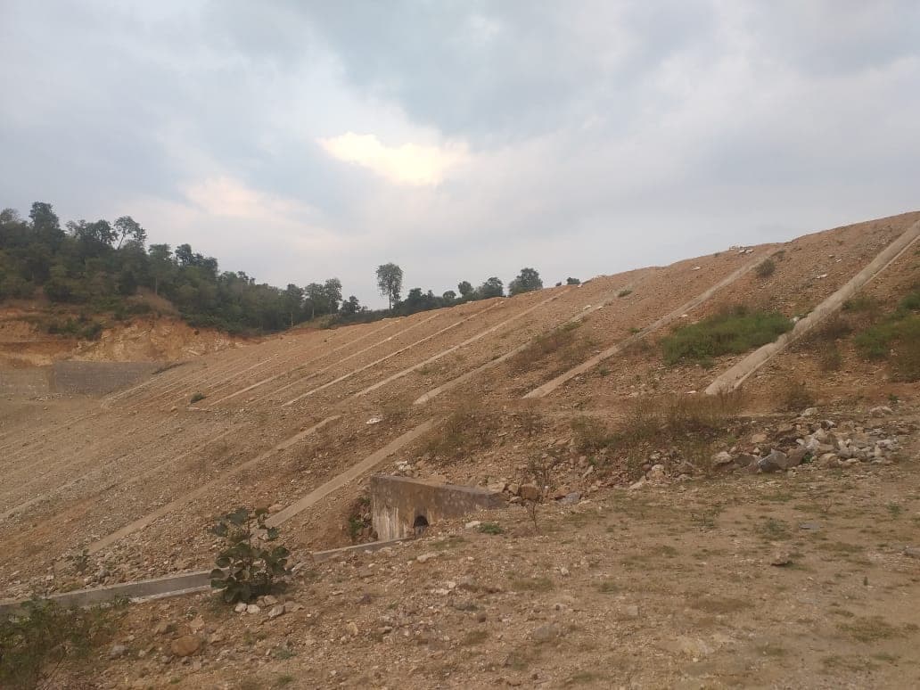
Mamer Dam is an earthen dam on the Local Nala in Udaipur district, Rajasthan, completed in 2019; the National Register of Specified Dams 2025 records it as 15 m high above lowest foundation level, a crest length of 170 m, with a gross storage capacity of 2.19 million cubic metres (register identifier RA67MH0261).
- Sources
- 1
- Ranked on
- 3 lists
Measurements
Height above lowest foundation level · 15 m
Crest length · 170 m
Gross storage capacity · 2.19 MCM
Live storage capacity · 1.99 MCM
Spillway capacity · 279.84 m³/s
Source for the figures above
- National Register of Specified Dams 2025cwc.gov.in
“"Specified Dam" means a dam constructed before or after the commencement of this Act, which is, — (i) above fifteen metres in height, measured from the lowest portion of the general foundation area to the top of dam”
Location
Appears on
Also on Dams of Udaipur District
Mamer Dam is no. 35 of 52 on this list.
- Adwas Dam
- Akodra Dam
- Amar Chandiya Dam
- Ambamata Dam
- Badgaon Dam
- Bagolia Dam
- Banoda Dam
- Bari Dam
- Baxa Ka Naka Dam
- Berach/Vallabh Nagar Dam
- Bhudar Dam
- Bhuj Ka Naka Dam
- Chawand Dam
- Daya Dam
- Dewas Ist Dam
- Do Nadi Dam
- Fateh Sagar Dam
- Fila Dam
- Ghoda Khoj Dam
- Goriya Dam
- Har Ka Naka Dam
- Harchand Dam
- Imli Ka Naka Dam
- Jai Samand Dam
- and 27 more